
Trails that do it all: Where active transportation meets outdoor recreation
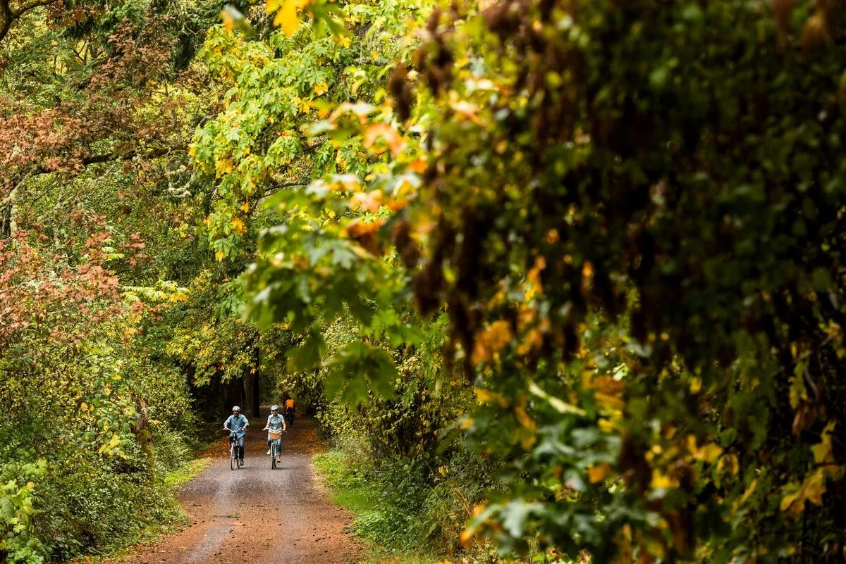
Photo: Destination BC and Reuben Krabbe.
If you want to go mountain biking on Hornby Island, you can drive onto the Buckley Bay ferry to Denman Island, drive across the island and then ferry over to Hornby and drive to one of the trail heads for Mount Geoffrey Regional Park. Or you can pedal onto the ferries and ride the gravel pathway bisecting both islands.
With the near completion of the Denman Cross-Island Trail, which parallels but is mostly separate from the road, biking on the island is safer and more pleasant. While some folks use it to get somewhere, others are riding it as an adventure in and of itself.
Both the Hornby Island trail and the new Denman trail were funded by the provincial government’s Active Transportation Infrastructure Fund. But like many of these types of projects it’s hard to separate whether they are active transportation or outdoor recreation. That’s what makes them so valuable to communities, says Meghan Winters, a professor in the Faculty of Health Sciences and the head of the Cities, Health and Active Transportation Lab at Simon Fraser University.
“There are so many different aisles these trails can sit under: carbon reduction, climate resilience, access to nature, active transport, and recreation, to name a few,” she says.
Often, trails and paths preserve linear parks along their length, creating easy access green space and wildlife habitat, while encouraging physical activity. They can be commuter routes, recreation enablers and tourism destinations.
Connectivity is a key to making the most of them. In his masters thesis on the value of collaborative trail planning Erik Morton notes the multiplier effect of using trails to link trail networks as well as linear paths within a network. He quotes Chris Crawford, the President of the North Okanagan Cycling Association.
“We want mountain bike trails, but it'd be great to be able to ride from your home to those bike trails,”Crawford told Morden. “Often we now need to plan with the City, the Regional District, Crown Land, Parks. It's that collaboration and then the interconnectivity that I think are the big priorities.”
Resort communities have been doing this for years, Winters points out.
For instance, Whistler’s Valley Trail is the resort’s artery. For locals and visitors pedalling or walking the trail is often the most efficient way of getting around as it avoids traffic lights, pay parking and traffic jams. With spur paths, it connects almost every neighbourhood and many of the most popular attractions, including lakes, parks, and hiking and mountain biking trails. Many residents use it to commute and some visitors use the path as a way of experiencing the area. And with the Sea to Sky Trail connecting on either side of the municipality, the Valley Trail is also part of a 180 kilometre trail.

Image: Tourism Whistler & Justa Jeskova.
A similar paved pathway connects rainforest walks, surf pounded beaches, campgrounds, neighbourhoods and tourist towns on the west coast of Vancouver Island. Stretching 44 kilometres between Tofino and Ucluelet, the trail just off the Pacific Highway was built in stages by the various land owners, including the District of Tofino, town of Ucluelet, Parks Canada and the Alberni-Clayquot Regional District. Residents use it to commute, walk their dogs and access beaches, while many of the one million tourists who visit the area each year pedal and walk on the path during their stay.
Tourism is a key component of an even longer pathway system under construction in the Lower Mainland. The goal of Experience the Fraser is to connect Hope to the Salish Sea with 550 kilometrers of multi-use paths, side roads, and river trails. First proposed in 2012 by the Fraser Valley Regional District and Metro Vancouver, about half the route is open with more under construction. Destination BC has taken over leadership of the project with support from almost every community that banks the Lower Fraser River.
The provincial government has committed tens of millions of dollars to these projects, part of more than $127-million it has invested in active transportation projects since 2017. These can be complex endeavours, involving extensive community engagement and planning, says Winters. Often the biggest challenge is working through overlapping jurisdictions: railway right of ways, approvals from different government agencies, and negotiating with various property owners.
In the Pemberton valley, a mountain bike trail network and rural neighbourhood sit directly across the Lillooet River from the Pemberton downtown, but about six kilometres by road. Sharing an existing railway crossing could eliminate the need to drive for residents coming into Pemberton to go to school, work and shop and mountain bikers living in Pemberton to access the trails. But the rail company is not interested in sharing the bridge with pedestrians and cyclists. A dedicated pedestrian bridge would be expensive and face significant environmental challenges. So a logical active transportation link remains broken.
To simplify the jurisdictional challenges, the province’s Active Transportation Infrastructure Grant program only funds projects on Ministry of Transportation and Infrastructure right-of-ways. (The province handed out $24-million through the grant in 2024.) That was the case with the Cycle 16 multi-use pathway, which will soon connect Smithers with the nearby community of Telkwa.
“This trail will not only increase safety, but also encourage active lifestyles and add to the availability of safe, accessible outdoor recreation opportunities for residents and visitors,” said Mark Parker, the board chair of the Regional District of Bulkley Nechako.
It’s not quite that simple, warns Winters. For commuter routes to also be recreation destinations requires two more important ingredients.
The first is place-making: adding destinations and features along the pathway.
“They are the reason to go, the place to stop and catch your breath, the enticement to convince kids to come along,” she says.
This could be as simple as routing the path so it connects with parks, visits a stream, or connects to other trail networks. Or it could be adding features like information boards, pollinator gardens or playgrounds.
The second key ingredient is wayfinding. It’s easy if the path is linear and obvious, but if it’s not, signage and directions need to be clear physically and virtually.
“It really needs to be clear where the path is going to take them, where they can get food and water,” she says. “Wayfinding is really important and not expensive.”
Winters points to La Route Verte bike touring system in Quebec as an example to copy. The tourism initiative has planned 5,400 kilometres of cycle routes in the province, often on dedicated multi-use paths. The website includes detailed route suggestions, the on-the-ground signage is clear and easy to follow, and a support system of accommodation and shuttles makes the planning and executing simple.
The potential exists to create similar experiences on the Okanagan Rail Trail and Cowichan Valley, for instance, but the wayfinding needs work, she says. The Trails Society of BC has been working on this as part of routing and promoting the Trans Canada Trail through B.C.
This is an area where outdoor recreation clubs have expertise. They are experts in helping people navigate complex trail systems and terrain. And there is certainly a need to connect people to outdoor experiences with active transportation options, says Winters.
“It’s really important for health, well-being and equity,” she says. “Rarely is there frequent bus service to green spaces. With the increasing density of our cities and the growing pressure on our parks, there is a need to make new connections.”
The Denman Island Cross-Island Trail is just such a project. Completed this year, it makes travelling across the island by bike safer and more approachable. More and more people are riding onto the island instead of using their car. Tourists linger on the island longer, stopping for coffee, walking on one of its hiking trails, swimming in a lake or browsing the bookstore. Sometimes they don’t even make it to Hornby.
Residents or visitors, they are reducing their carbon emissions and boosting their mental and physical health. All because of a strip of gravel. The humble trail is good for the planet, good for rural economies, good for people, and good fun too.